Mindanao Tremor: 7.8 Magnitude Quake Kills 32, Sparks Tsunami Fears Across Asia
Philippines Earthquake: 7.8 Magnitude Quake Kills 32 in Mindanao, Triggers Tsunami Across South Asia
A massive 7.8-magnitude earthquake has devastated the southern Philippines, leaving at least 32 dead and triggering tsunami warnings that rippled across coastal communities in South Asia.
The morning of June 8, 2026, began with a violent rupture off the coast of Mindanao, as a 7.8-magnitude earthquake struck at 7:37 a.m. local time. The tremor, centered 32 kilometres southwest of Maasim town in Sarangani province at a depth of 33 kilometres, was the strongest to hit the Philippine archipelago this year. The seismic activity was so intense that it sent one-metre tsunami waves crashing into coastal provinces, forcing authorities to issue urgent alerts across the region.
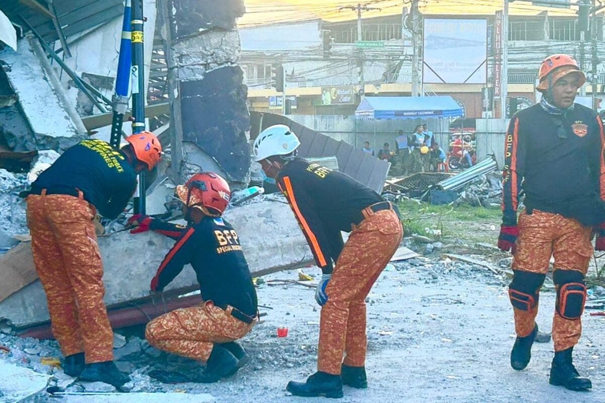
The human cost has been significant and is expected to rise. Disaster-mitigation officials confirmed that 32 people have lost their lives, with over 200 others injured. In the mountainous town of Glan, 13 residents died when a landslide buried their homes. The port city of General Santos—a vital hub for the nation’s tuna exports—bore the brunt of the structural destruction. With several buildings collapsed, including a two-storey school, authorities are currently searching for at least 12 people reported missing.
Further casualties were reported across South Cotabato, Davao Occidental, and Balut Island, where victims succumbed to falling debris or structural failures, including damage to a local mosque. Teresito Bacolcol, director of the Philippine Institute of Volcanology and Seismology (PHIVOLCS), noted the scale of the impact, as the quake’s force triggered tsunami warnings that extended far beyond the immediate coastline, drawing concern from neighbours including Japan and Indonesia.
Why it matters
The Philippines sits squarely on the Pacific "Ring of Fire," a zone of high tectonic activity, making it one of the most disaster-prone nations in the world. This event highlights a persistent vulnerability: the intersection of rapid, high-density urban development and seismic instability. While early warning systems for the tsunami were activated, the sheer power of a 7.8 magnitude quake creates challenges that go beyond simple evacuation; it tests the structural integrity of infrastructure in regional hubs like General Santos. For the broader South Asian and Pacific region, this disaster serves as a grim reminder of how quickly a local maritime tremor can evolve into a trans-boundary threat, necessitating deeper regional cooperation on disaster mitigation and maritime surveillance.
Rescue operations remain the priority as the Bureau of Fire Protection and local civil defence teams navigate the debris. With thousands of residents displaced and critical infrastructure damaged, the coming days will be a test of the Philippines' emergency response capacity. The international community is closely watching the situation, as the potential for further aftershocks remains high, keeping coastal communities on edge.
World Desk at PoliticalPedia covers global affairs for an Indian audience in English and Hindi.