Chaos in Mindanao: At Least 4 Dead and Over 200 Injured After 7.8 Magnitude Earthquake Hits Philippines
At Least 4 Dead, Over 200 Injured After 7.8 Magnitude Earthquake Hits Philippines
A powerful seismic event has rattled the southern Philippines, triggering regional tsunami alerts and leaving communities in a race against time to rescue survivors from the wreckage.
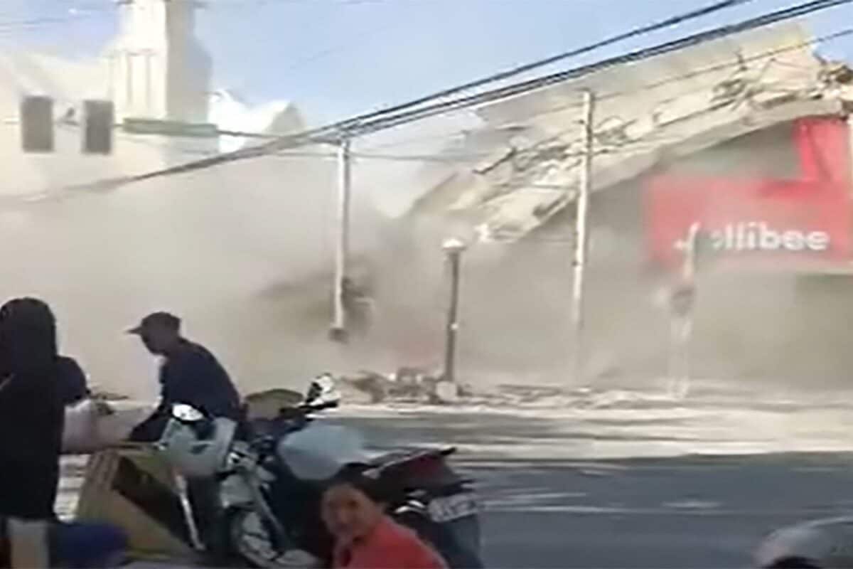
The ground in the southern Philippines gave way on Monday morning, June 8, 2026, when a massive 7.8 magnitude earthquake struck the Mindanao region. The sheer force of the tremor turned familiar streetscapes into zones of destruction; images circulating on social media, including on Facebook, captured the harrowing moment a Jollibee fast-food restaurant collapsed in General Santos City. As of this report, state authorities have confirmed at least four people are dead, with more than 200 others injured after being caught in the structural failures.
The impact was immediate and widespread. Philippine authorities and disaster response teams have been scrambling to reach those trapped under debris, with the Philippine National Police confirming that several casualties were recorded in Region 12. Beyond the immediate structural damage, the earthquake’s intensity prompted urgent tsunami alerts not just within the Philippines, but across borders in Japan and Indonesia, highlighting the precarious geography of the "Ring of Fire."
The Tsunami Threat and Regional Anxiety
While the primary concern remains the safety of those in Mindanao, the potential for secondary disasters has kept the broader region on edge. The Pacific Tsunami Warning Center and local agencies in neighbouring countries monitored coastal waters closely as tsunami waves were confirmed to have been triggered by the seabed displacement. For residents in these coastal zones, the memory of past seismic events makes every tremor a source of profound anxiety, and the rapid dissemination of alerts via social media channels became a lifeline for those trying to assess their risk in real-time.
Why it Matters: The Geography of Risk
This disaster underscores a grim reality for nations situated along the Pacific tectonic plates. While modern engineering and early warning systems have improved significantly, the 7.8 magnitude scale of this quake serves as a reminder that architectural resilience remains the biggest hurdle in mitigating casualties. The concentration of damage in urban centres like General Santos City reveals that even well-established commercial hubs remain vulnerable to high-intensity shaking. The pattern is clear: in regions prone to such volatility, disaster preparedness is not merely a bureaucratic requirement but a constant, everyday necessity for survival.
As search and rescue operations continue, the focus will likely shift toward assessing the long-term impact on local infrastructure and the economic strain on the southern provinces. For now, the priority remains the triage of the injured and the stabilisation of sites at risk of further collapse. While social media is currently flooded with footage of the aftermath, the official toll—though currently cited at four dead—is being monitored closely by agencies like News18 as the search teams move deeper into the affected areas.
Features Desk at PoliticalPedia covers culture, tech & life for an Indian audience in English and Hindi.