How Real-Time Satellite Intel Is Making Ukraine’s Drone Strikes Deadlier Than Ever
Real-Time Satellite Intel Is Making Ukraine’s Drone Strikes Deadlier Than Ever
By integrating commercial orbital imagery with tactical battlefield operations, Ukrainian forces are slashing response times and pinpointing Russian assets with unprecedented accuracy.
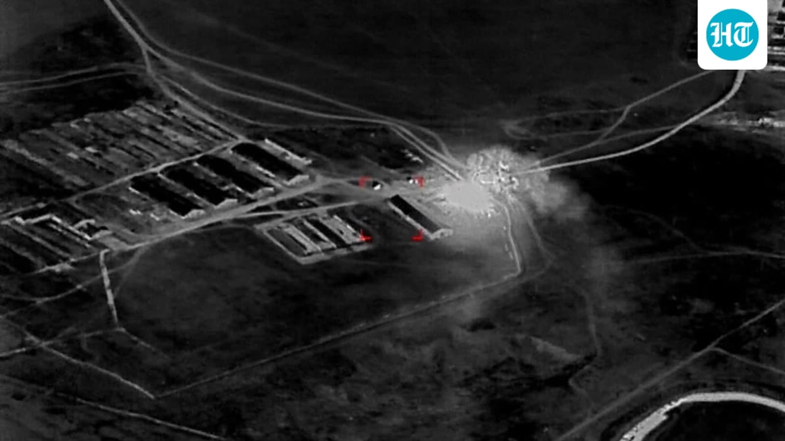
In the dense, foliage-heavy terrain of southeastern Ukraine, the camouflage netting and tree cover that once shielded Russian operations are proving increasingly ineffective. Ukrainian military units, long accustomed to the grinding reality of a conflict deep into its fifth year, have turned to a sophisticated technological integration: high-definition satellite imagery beamed directly to the handheld devices of frontline soldiers. This shift, which is making Ukraine’s drone strikes deadlier than ever, represents a significant evolution in how modern asymmetric warfare is being waged.
Shrinking the Kill Chain
The tactical advantage lies in the speed of the information cycle. Traditionally, reconnaissance drones faced visibility challenges when scanning through thick canopy or urban cover. However, by supplementing these local assets with near-real-time data from Colorado-based Vantor’s commercial satellite constellation, commanders are drastically shortening the "kill chain." According to those involved in the deployment, the time required to locate a target and initiate a strike has plummeted by as much as 90%.
For soldiers in the field, this means that data—often captured over several days of orbital surveillance—is now available on smartphones and laptops. In one recorded instance, this intelligence allowed a unit to identify the specific metal frames of armored vehicles parked near a suspected Russian command node. Once the location was verified, the team launched an attack drone with precise coordinates, effectively neutralizing the target and proving that real-time satellite intel is becoming a decisive factor in local skirmishes.
A New Era of Tactical Advantage
As the conflict persists, the ability to launch accurate, long-range strikes against logistics hubs and air defense systems has become a central pillar of Ukraine’s defensive strategy. While observers often look for updates in the Hindustan Times or similar outlets to catch the pulse of global city and junction politics, the real story of this war is unfolding in the digital integration of space-based assets with ground-level combat. This is the first known instance of such a comprehensive commercial-to-military pipeline being utilized at this scale.
The innovation is not merely about finding targets; it is about the software that accompanies the imagery. By allowing soldiers to investigate and analyze geospatial data on the fly, the Ukrainian military is compensating for manpower constraints with high-tech efficiency. Even as the Delhi diplomatic circles monitor the broader implications of the war, the reality on the ground is that the battlefield has become a testing ground for technologies that bypass traditional, slower intelligence-gathering methods.
The Cost of the Conflict
Beyond the immediate tactical gains, this technological leap highlights the relentless pace of adaptation in a war that continues to claim lives and disrupt regional stability. While the international press continues to track the human cost—from incidents involving civilian disputes to the complexities of real estate and urban life—the military front remains a high-stakes arena where every millisecond of data matters. For the Russian forces, the loss of the "blind spot" provided by tree cover and shadows signifies that the advantage is shifting, forcing them to reconsider the security of even their most hidden logistics centers.
The PoliticalPedia Editorial Desk brings verified, sourced political news and analysis from across India.